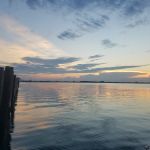
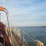
8/9/18: We planned our departure from Cape May on a day with a perfect weather prediction for the crossing. The forecast said 5 knot winds and 2 foot seas. The only downfall was the tide. It was an ebb tide (outgoing) for most of the day, which was going to cause a 2 knot current against us. This was going to lengthen our crossing by a couple hours. Still, it was looking to be a nice, relaxing, but long, day to cross the Delaware Bay. Do you think, for once, they could get the weather forecast right? Nope!
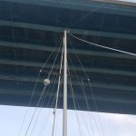
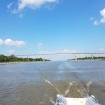
Before entering the Delaware Bay, we had to go down the Cape May Canal. This 3 mile long canal cuts through the cape of New Jersey from Cape May Harbor to the Delaware Bay. Without the canal, mariners had to go around the cape, which has shallow shoals extending for miles out to sea. Using the canal cuts off about 15 or 20 miles of travel – well worth it. There are 2 bridges along the canal, and we were told that the first was only 53 feet at high tide, and our mast height is 53 feet. But the charts (and every other online reference we found) said both bridges were 55 feet, which shouldn’t be a problem at any tide. Because of how shallow the marina we were in was, we had to leave at high tide (lucky for us, this was at 6am, giving us the whole day to cross the bay). But we were certainly concerned about that first bridge – was it 53 as we had heard, or 55 as the charts said? We decided to trust the charts. We entered the canal and crept up to the first bridge. And slid right under. We looked at each other, and then exhaled. The second bridge was no problem, either. A half hour later, we entered the Delaware Bay.
Before we left, we had to decide how far we wanted to travel this day. We could anchor somewhere in the bay for the night, or we could push all the way to the Chesapeake Bay, or stop somewhere along the C&D canal. Anchorages in the Delaware Bay are scarce, and for those that do exist, there are wicked currents to contend with. Because of the tidal changes, most places in the bay have reversing currents, and those can run as strong as 3 knots. We didn’t feel much like anchoring under those conditions, so the bay was out. And because of the outgoing tide for most of the day, making the Chesapeake Bay could take us 16 hours, and probably more. There were a couple marinas along the C&D canal where we could stop, so we chose one in Chesapeake City, about 3/4 the way across the canal. It would still be 12 or 13 hours, but more doable.
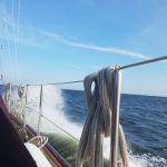
The first thing we noticed was the wind. Was it 5 knots? Nope, it was blowing at 15! The second thing we noticed were the waves. Were they 2 feet? Nope, they were 3 to 4 feet! No worries, though, just another day like up on the Great Lakes. Except that within 2 hours, the winds topped 20 knots and the seas grew to 4 to 6 feet. We had the tidal current against us, so we had those conditions for the next 8 hours. Once we entered the Delaware River proper and were within a few hours of the C&D canal, the winds died, the seas calmed, and we entered the forecasted weather: 5 knot winds and 2 foot seas. But we were already tired from bucking the waves for 8 hours, and we still had 4 or 5 hours to go.
We entered the C&D canal and made the 10 mile trip to the marina. When we arrived (around 7:30 that evening), we didn’t realize that this “marina” wasn’t a marina at all – it was just a long dock in front of a restaurant. We tied up right in front of a bunch of customers eating dinner on the terrace outside. We were hot, and sweaty, and tired from the long day we just had, and we really wanted to shower. But this “marina” had no showers. They didn’t even have bathrooms we could use unless we ordered dinner! Unfortunately, there weren’t any other good options, so we decided to spend the night there.
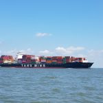
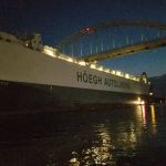
The C&D canal is a busy place. It connects the northern part of the Chesapeake Bay (the “C”) to the northern part of the Delaware Bay (the “D”). It was originally built in the early 1800’s to to shorten the commercial trade between Baltimore and Philadelphia. It cut off hundreds of miles of travel for commercial traffic. It’s since been widened and deepened to accommodate today’s ships, but it is still heavily used by both commercial and recreational vessels. While we were tied to the wall, we saw several tugs pushing cargo, and even one container ship that went through. It’s quite a sight seeing a huge container ship only 50 feet away navigating the canal!
We finally crawled into bed, thankful for the day to be over. We had to wait until 10:00 the next morning for a favorable tide to get us into the Chesapeake and down to the next marina. At 10:00 we pushed off, and an hour later we entered the Chesapeake Bay. It took one full month for travel that should have taken 10 days or less, but we made it! Happy dance! Now, on to our first marina to, you guessed it, wait out another few days of bad weather before heading out to explore “the bay”. Onward!
